
Gone are the days when surveyor transits with steel chains and total stations were the primary methods of measuring a site. Now, point cloud scanners and drones are used to collect survey data for use in site developments and roadway construction plans.
Drone technology is becoming more widely used in the world of crash reconstruction and has become an important addition to the forensic litigation toolbox. Crash sites can be surveyed, and site evidence can be documented from above using drones. The overhead perspective that drones provide can be very helpful when documenting crash site information, such as skid marks, gouge marks, scrape marks, travel paths made outside of paved surface areas and scene pavement markings. With today’s technology, collected data can even be shared directly from the field.
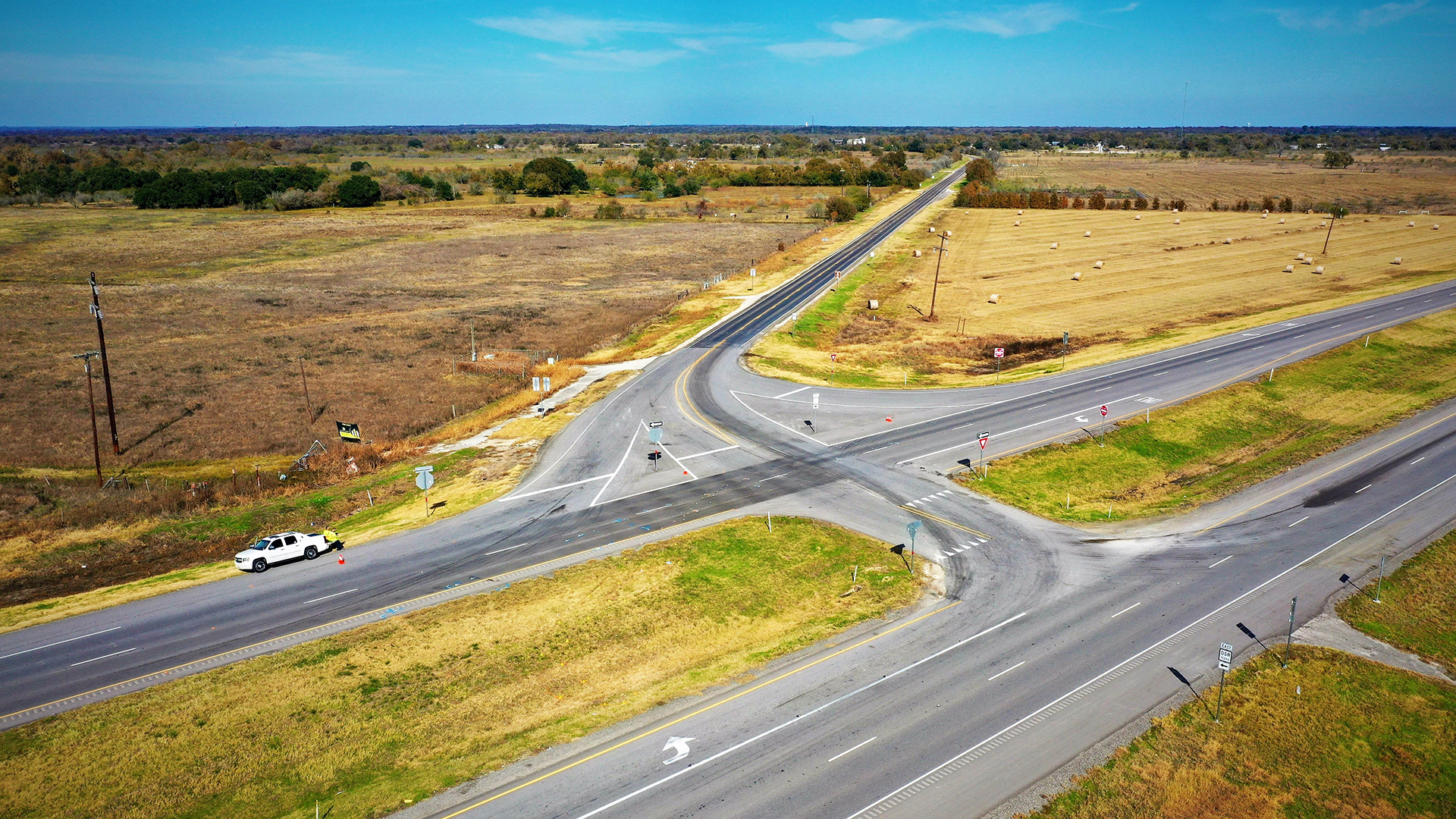
Using drones, we can capture planar and oblique views of roadways, roadsides, parking areas, evidence, and terrain which otherwise would be unattainable and invisible from the roadside or common public access areas. The utilization of drones at traffic crash scenes allows us to capture objective physical evidence from overhead and at diverse angles and travel paths, thus replicating a driver’s approach path including traffic signs and signals as well as the roadway geometry and condition. Using drones to capture scene and roadway information and evidence enhances the data collection quality and has proven to be a time saver, which in turn correlates with savings for our clients.
Using supported software, data collected by drones can be used to create three-dimensional data clouds from which scaled 2D and 3D layouts and animations can be developed to illustrate crash scenarios. When available, recorded video from vehicles, locomotives and security cameras can be incorporated into the collected drone data to develop accurate illustrations and animations of the crash scenario. Drone photography and video imaging quality has improved greatly in recent years and those images make excellent visual aids and exhibits for courtrooms or large presentations.
In addition, drones can make it safer to perform crash surveys. Because drones can perform crash site surveys from above, drone operators are able to do so at a safe location, off the roadway and separated from vehicular traffic. This not only maximizes the operator’s safety but provides less of a distraction to motorists on the roadway. Drones can also be used to collect data in locations that may not be accessible otherwise, such as bridges or roadway sections with no shoulders, as well as topographical features, vehicles, and full crash scenes, all while the operator maintains a safe distance.
Crash reconstruction is not a precise science; however, drone data collection eliminates most human surveying errors. The collection of drone-generated information at crash sites provides the reconstructionist with excellent supporting data and the ability to develop a more accurate recreation of the crash. In the very near future, it is likely that drone technology will replace point cloud scanning as the primary source of site data collection, relegating point cloud scanning to capturing vehicle crush damage or other specific applications.
To talk more about using emerging technology in crash reconstruction, feel free to contact us.